Planning an Automated Mission
Via QGC on the Herelink
The payload can automatically be triggered at regular intervals to capture images in automated missions. This guide shows the steps for planning a mission on the Herelink version of QGC, but it will be nearly identical if planning the mission on the PC version of QGC.
Follow this guide to plan an automated survey mission.
Click the “Plan” icon in QGC.

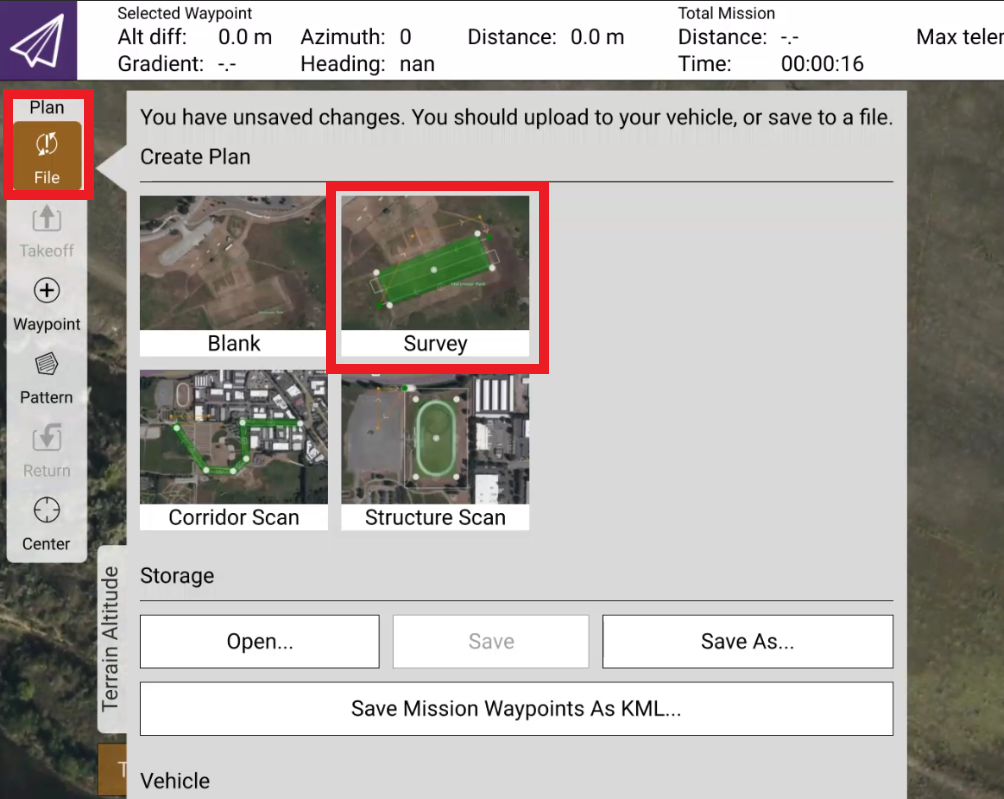
Click the “File” and then the “Survey” option.
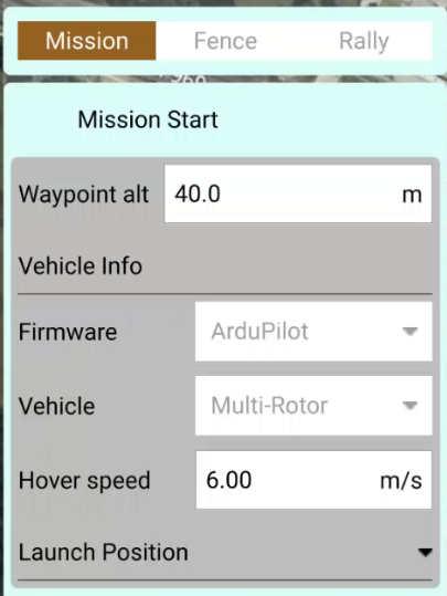
On the “Mission Start” tab, set your desired waypoint altitude (AGL) and your estimated hover speed for the mission (this can be changed later on).
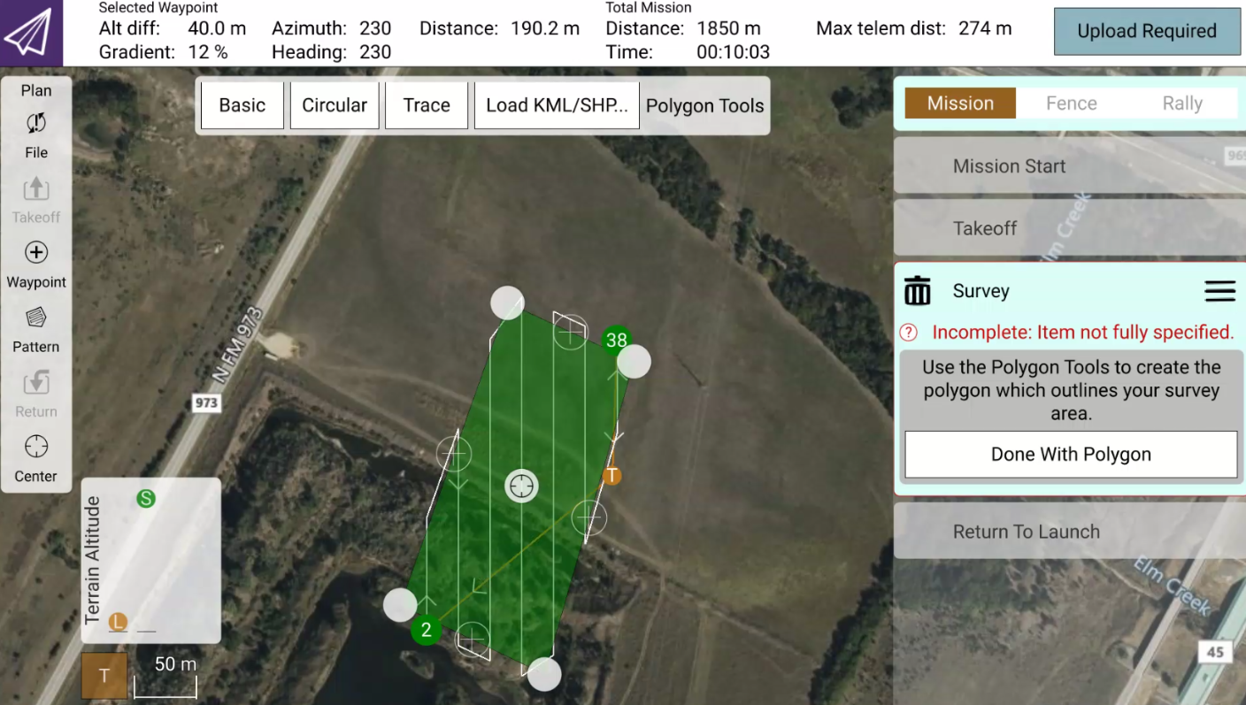
Drag the takeoff location on the map to the anticipated takeoff location of the mission. In the Takeoff tab on the right, make sure you enter the altitude to which you want to drone to reach on takeoff.
Click the Survey tab on the right and then click “Basic” for the polygon type. Drag the polygon edges around to cover the region you want to scan. You can add polygon corners by clicking the “+” icon between existing polygon corners. Once you have established your polygon shape, click “Done With Polygon”.
In the “Camera” section, select “Custom Camera” and enter the following parameters: Sensor Width: 35.81 mm Sensor Height: 23.88 mm Image Width: 7360 px Image Height: 4912 px Focal length: 21.0 mm (or whatever focal length you have for your lens)
In the “Grid” tab, select the desired Front Lap and Side Lap for your particular use case, select either the Altitude or the Ground Resolution that you desire, and optionally, adjust the angle of the flight plan.

You can adjust the Turnaround distance and select various options, such as whether the camera captures images during the turnarounds or not. You’ll also see the area, photo count, photo interval, and trigger distance for this particular mission.
You want to keep the Photo Interval greater than 0.5 seconds in order for the system to capture without skipping or losing images. You can adjust a variety of factors in the flight plan to increase the interval, such as the flight speed. Decreasing the flight speed will increase the photo interval.
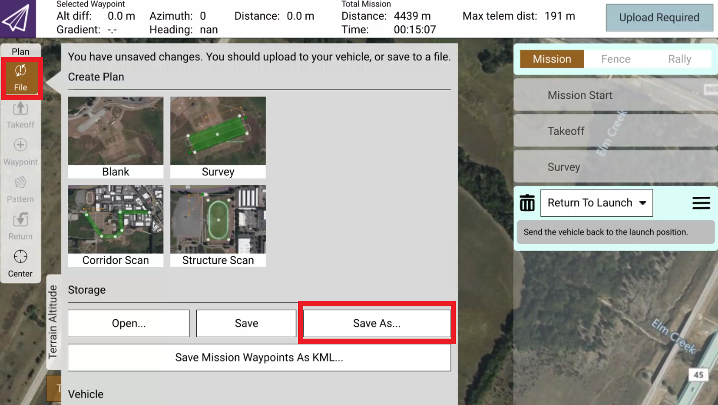
If you want to save this flight plan for later (it is saved on the Herelink - or the PC if you are planning on the PC), click the “File” button and click “Save As”
Enter a name for the mission and click “Ok”.
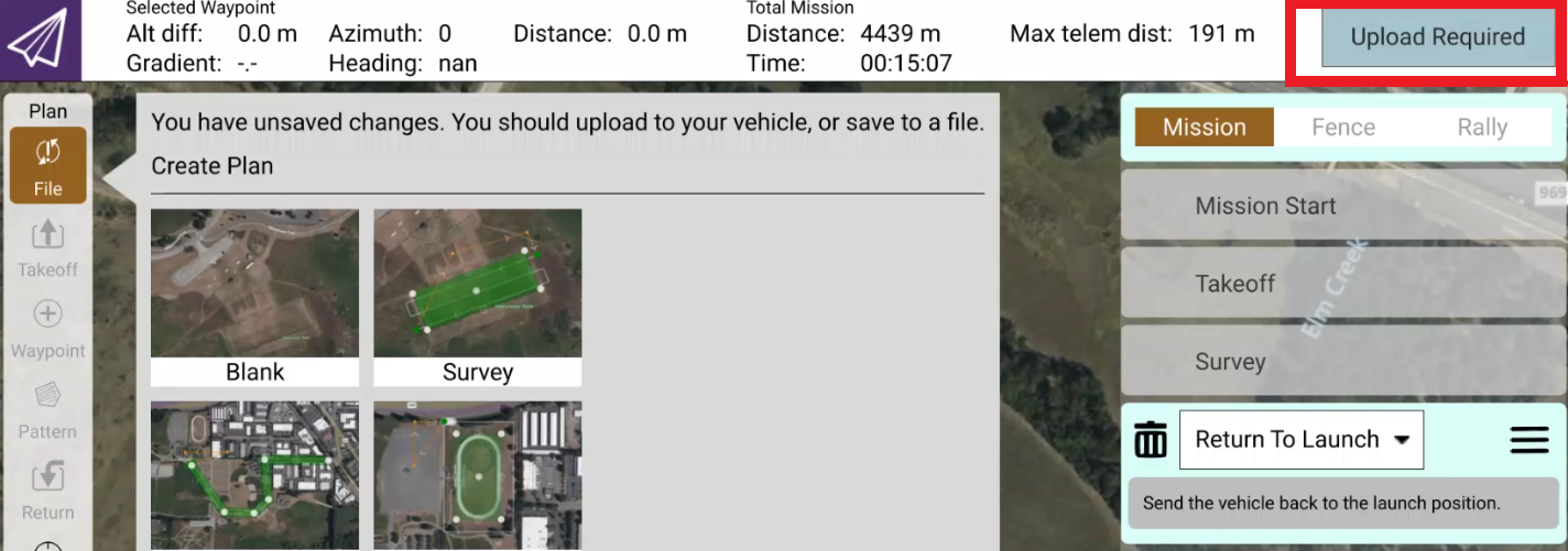
Once you are ready to use the mission on the X55, you will have to upload the mission. The X55 will have to be powered on and the Herelink will have to be connected first. When you are ready to upload the mission, click on the “Upload Required” button from within the mission planning tab.
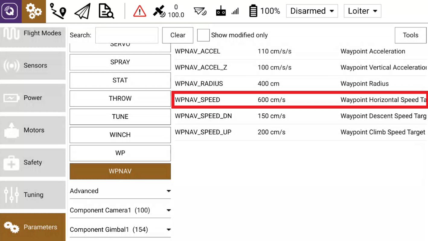
For whatever speed you set in the mission plan, you should accordingly adjust the WPNAV_SPEED parameter to be the same. For example, in the above case we used 6 meters per second as our mission speed. Here, we want to set the speed to match that, but it will be in cm/s. Simply multiply the flight speed by 100. Set this parameter and click “Save”.
Once the mission is uploaded to the X55, the system is ready to begin the automated flight. Make sure you follow all of the steps in the X55 (and Hybrid Module) Operation Manuals for preparing the system for flight, and follow all of the pre-flight checklist items before proceeding.
This payload uses the AirPixel ENTIRE for geotagging and as such, the startup and landing procedure is slightly different. First, take off manually in LOITER mode and rise up to about 5 meters off the ground and hover.
The ENTIRE will trigger the camera, access the USB connection of the camera, and then release control again. After this, the MavCam application on the Herelink should show that things are good to go (GTG). Do not proceed if it is blinking red!
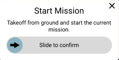
If things are good to go, from the Fly View of QGC, slide the slider bar to the right. Alternatively, you can press the “C” button on the Herelink controller, which is set up to trigger Auto mode by default.
Allow the mission to run its course.
When you are done with the capture session, land the X55 (either manually or automatically via the mission).
Wait for 15 seconds to 1 minute as the ENTIRE setup does the geotagging. The ENTIRE waits to find out that the drone has landed, and then goes into the camera USB connection to geotag the images. During this time, you will see the “ENTIRE CONNECTION” go offline, and your live-view will show that the USB connection is being accessed. When this process is complete, the playback view of the last image will appear on your controller screen, and the “ENTIRE CONNECTION” should be “ONLINE” again.
If the above was completed successfully, you can power down the system with the following steps:
Power off the drone
Power off the controller
You can now remove the SD card and copy the files over to your computer. When you right-click on the image and select “Properties”, you should be able to go into the “Details” tab and see the GPS information on the image:
You can use these geotagged images in the post-processing software of your choice.
Via Mission Planner
You can also use Mission Planner to set up an auto mission. If you are using the hotspot or network connection feature of the Herelink, and using a laptop or tablet to plan with Mission Planner, follow the instructions below.
In the “PLAN” tab, draw a polygon and then right click and select “Auto WP” -> “Survey (Grid)”
Select the Sony A7R option from the drop-down and populate some temporary information that is reasonably close to your flight profile. In this case, the altitude will be 30m, the angle will be 280 (more or less going parallel to the longest dimension of the survey grid), and the flight speed will be 5 meters per second. Make sure that the “Add Takeoff and Land WP’s” is selected, and “Use RTL” is selected.
Go into the “Camera Config” tab and make sure the lens setting is 21.0mm for the focal length, unless you are using a different focal length lens. Make sure the rest of the settings, in terms of the image width and height, and the sensor width and height match.
In “Grid Options” you will mostly adjust overlap and sidelap so that you ensure you have adequate coverage for the mission. The “OverShoot” and “LeadIn” is also used to ensure the system turns around completely before starting to capture images again. 10-20m is a good setting.
When you are done, the status should show you the mission profile:
In this case, we need to make sure that the shutter speed is at least 1/1428. On fairly bright days, 1/2000 shutter speed should be fine to use. We recommend not pushing the photo interval below about 0.8 seconds. For example, if you increased the flight speed, this interval would decrease. If you need a higher ground resolution, you would have to fly at a lower elevation. You can experiment with the mission settings and see how it changes the outcome. The most important thing is to make sure that the mission will clear all obstacles and be above the highest point of the area you are scanning.
Once you are done, click the “Accept” button and it will generate the mission commands.
Once here, click on line 1, and then click “Add Below”
Add a “DO_MOUNT_CONTROL” command between the takeoff and the first waypoint, and enter -90 for the pitch command:
The mission is ready to be either saved for later use (click “Save File”) or uploaded directly to the drone, if the drone is connected (click “Write” and wait for confirmation of success).
Follow the steps in the previous section for initializing and running the drone with the mission.
Last updated